![]()
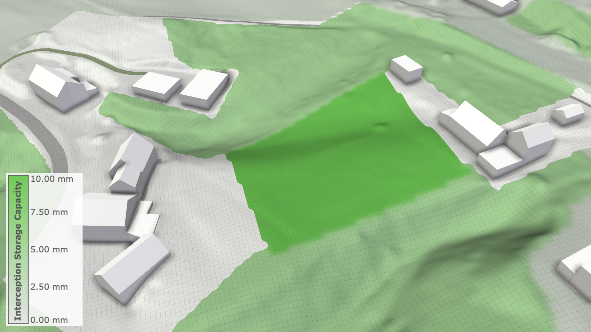
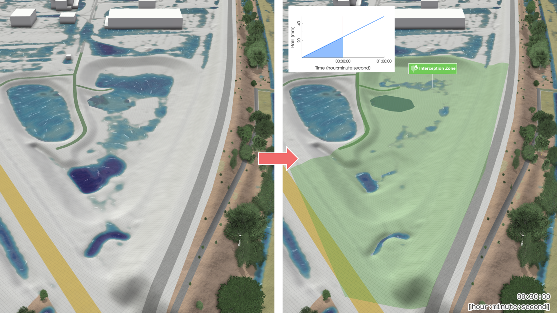
Interception Zone
Creation Mode: Draw Polygon on Terrain
Purpose and Effect: This action enables users to modify interception properties within the zone. Interception refers to the process by which precipitation is captured by vegetation or other surfaces before reaching the ground. This action allows for local adjustments to interception parameters.
There is a terrain visualization for interception available. It can be activated through the Visualization Settings Panel, in the Layers: Visualization category. To do so, enable the terrain layer and color it using the Surface: Interception Storage Capacity property.